Geosemble a Standout in DARPA 2010 Success Report
The report highlights Geosemble’s ability to develop and commercialize technology for bringing textual content to geospatial imagery and maps.

El Segundo, CA, September 30, 2010 --(PR.com)-- Geosemble® Technologies, Inc. has been highlighted in a recent report by the Defense Advanced Projects Agency (DARPA) as a uniquely capable company in the development and commercialization of technology for delivering textual content to geospatial imagery and maps. The report provides information on the technology, commercialization, and customers and provides lessons learned as part of the commercialization process.
“Our DARPA program was very important in helping us develop the right geo-faceted technology that today helps organizations search, discover and manage text information geographically,” said Andre Doumitt, Geosemble’s CEO. “What we discovered is that about 80% of online content has a geographic component, and we estimate that over half of that number has no address or latitude-longitude information. That’s the content area we focus on and that’s where we deliver value to our customers,” he said.
The DARPA report goes on to highlight that Geosemble took important commercialization steps to ensure adoption across commercial and government customers, starting with a detailed analysis of the customers’ work flows and data challenges. The company then followed up with the design and development of a visualization tool for understanding geographic regions, and secured several municipalities as customers. The report notes that Geosemble increased commercial revenue by 30% and won two Phase II Small Business Innovation in Research (SBIR) programs, followed by an investment from venture capital firm In-Q-Tel. The report also mentions notable partnerships, including the University of Southern California (USC) on natural language processing and clustering, and with Fetch Technologies Inc on data extraction and normalization. For more information or to read the report, please visit http://www.darpa.mil/sbpo/success/volume3/docs/GeosembleTechnologies.pdf
About Geosemble Technologies, Inc.
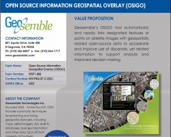
Geosemble’s products help organizations search, discover and manage text information geographically. The company’s flagship product GeoXray, links unstructured content to locations by assigning it a latitude-longitude value. The output of GeoXray can be tapped via API and displayed on a variety of systems, or on its own native GeoXray viewer. Uses for the product include Government and Military programs, municipal redevelopment, Business Intelligence and Enterprise Search, and geographic content delivery for mobile phone users. The company is an In-Q-Tel portfolio company, a DARPA SBIR Phase II contractor, a strategic Google® Earth Enterprise Partner, and a developer in the Oracle® PartnerNetwork,. Geosemble Technologies, Inc. is privately held. Learn more at http://www.geosemble.com.
About DARPA
The Defense Advanced Research Agency (DARPA) is the research and development office for the U.S. Department of Defense. DARPA’s mission is to maintain technological superiority of the U.S. military and prevent technological surprise from harming our national security. We also create technological surprise for our adversaries. DARPA funds unique and innovative research through the private sector, academic and other non-profit organizations as well as government labs.
###
Geosemble is a registered trademark of Geosemble Technologies, Inc. All other marks are the property of their respective owners.
For further information contact:
Geosemble Technologies, Inc.
Suite 400
841 Apollo Dr.
El Segundo, CA 90245
310-356-8307 x 7001
Inquiry [at] Geosemble [dot] com
Contact
Geosemble Technologies
Andre Doumitt
310 356 8307 x 7001
www.geosemble.com
Andre Doumitt
310 356 8307 x 7001
www.geosemble.com
Multimedia
Categories

