New Guide Book, Hiking Nevada’s County High Points, Describes the Adventure, Beauty and Solitude Found on Nevada’s Highest County Summits
In his new guide book, Hiking Nevada’s County High Points, published by Spotted Dog Press, Central Nevada resident and author, Bob Sumner, has put his life-long love of the desert into this historic adventure guidebook.
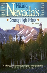
Many readers will recognize the familiar summits of Charleston Peak near Las Vegas and Mount Rose above Reno, however Hiking Nevada’s County High Points goes far beyond the known. Into the most remote depths of Nevada’s rural counties, Sumner’s routes cross the Great Basin where mountain ranges seem to float like earthen islands above the desert valleys, to the beautiful world of Nevada’s wilderness, remote and seldom visited, the big sky country of sagebrush and pine.
Hiking Nevada’s County High Points' trails meander through bristlecone pines, the oldest trees on the planet, to the summits Boundary Peak, Nevada’s highest and Wheeler Peak in Great Basin National Park to the historic overlook of Mount Davidson above Virginia City; along alpine lakes and cliffs to Ruby Dome; past herds of pronghorn antelope to Mount Jefferson in Nye County; around the old Pony Express trail in the pursuit of Desatoya, Churchill County’s high point.
Hiking Nevada’s County High Points is a comprehensive driving and hiking guide to the summits of Nevada’s 16 counties and Carson City. Author Sumner describes each backcountry adventure in abundant detail with chapters that include:
• Driving and route instructions
• Camping and lodging locations
• A “bonus” peak which can be combined with the county high point
• A side trip to a nearby point of interest
• Historic background for each high point
Outdoor enthusiasts from all over the country will appreciate the journeys contained in this “must have” guide to the state’s diverse and challenging high points. Alpinesque scenery, towering limber pines, lush riparian canyons, past wind-sculpted rock walls with hundred mile vistas are here for the exploring in Hiking Nevada’s County High Points.
About The Author: Central Nevada resident and Hiking Nevada’s County High Points author, Bob Sumner, has been hiking and climbing throughout the West for more than 25 years and has summited more than 1400 peaks. Editor of the venerable Desert Peaks newsletter, The Desert Sage, Sumner has contributed hiking articles for various publications. On any given weekend, Bob can be found exploring the most remote regions of the Silver State.
###
Wynne Benti
760-872-1524
http://www.spotteddogpress.com
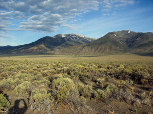
Bunker Hill, Lander County
Closest to the town of Austin, the view from the top of Bunker Hill includes the twin summits of Desatoya Peak rising up on the horizon; to the southwest the Shoshone Range, just across the Reese River Valley; south across Kingston Canyon, to the Toiyabe Crest. (Photo: Bob Sumner)
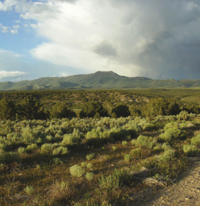
Diamond Peak, Eureka County
Diamond Peak is the most isolated peak in the book, Hiking Nevada's County High Points, and the views reflect it. (Photo: Bob Sumner)
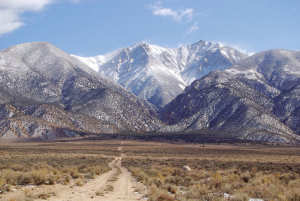
Boundary Peak, Esmeralda County
At 13,140-feet in elevation, Boundary Peak is the state high point. (Photo: Daniel Goodwin)
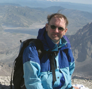
Bob Sumner
Hiking Nevada's County High Points author, Bob Sumner (Photo: Jerry Dea)

