Xplorer Maps Announces the Release of “Great Smoky Mountains National Park” Map
In collaboration with the Great Smoky Mountains Assocation (GSMA), Xplorer Maps and wildlife artist Chris Robitaille have created this incredibly unique artistic creation highlighting the fauna, flora, unique geology, iconic landscapes and historic structures of the Great Smoky Mountains. - May 28, 2015
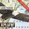
Xplorer Maps Announces the Release of the "Lake Tahoe" Fine Art Map
Through a collaborative partnerships with the Tahoe Heritage Foundation Xplorer Maps is proud to release this hand-lettered, gorgeous fine-art illustration of Lake Tahoe. Xplorer Maps is donating the original artwork in addition to a portion of all map sales in perpetuity to the Tahoe Heritage Foundation. - July 22, 2014
Xplorer Maps Announces the Release of "Banff National Park"
Canadian artist Chris Robitaille and Xplorer Maps have highlighted the incredible fauna, flora, unique geology and iconic landscapes of the greater Banff region including features of Kootenay and Yoho National Parks in the latest map release "Banff National Park." Every line, letter and icon in this old-world style map illustration is custom and entirely rendered by hand; absolutely unique and original as is every Xplorer Maps map. - July 18, 2014
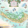
Xplorer Maps Announces the Release of “Sanibel-Captiva Island”
The Sanibel-Captiva Island Map takes you on an exotic journey through paradise with illustrative excerpts of the historic landmarks, iconic beaches, colorful flora and fauna, and the unique marine life of the region. “Sanibel-Captiva Island” was officially released at the Tween Waters Inn on November 19th, and 300 Limited Edition prints are now available for purchase online at www.xplorermaps.com. - November 22, 2013
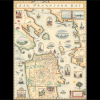
Xplorer Maps Announces the Release of “San Francisco Bay”
Xplorer Maps proudly announces the release of their hand-drawn, old-world style San Francisco Bay Area Map. A percentage of sales will benefit the San Francisco Museum and Historical Society. - February 12, 2013

